Aside from the standard Interstate, US, state, and county road markers,
you will find several other markers along Iowa's highways designating scenic
and historic routes. If you have additional information or routes to add
to this list, please let me know.
Images for the Delaware Crossing and River Bluffs Scenic Byways and the Glacier Trail were provided by Jeff Morrison, and the image for the Glacial Trail Scenic Byway was provided by Mike Ehret.
|
Overview
|

(current)

(1993-2011)
|
In August of 1993, Iowa state officials designated four routes as "Scenic
Byways" as an attempt to boost tourism. The Grant Wood, River Bluffs, Western Skies, and Woodlands (later renamed Historic Hills) Scenic Byways were the original four. The Iowa Valley Scenic Byway was added in 1998, and on July 11, 2000, the Driftless Area Scenic Byway and Glacial Trail Scenic Byway (then known as the Old O'Brien Glacial Trail) were designated while two new segments were added to the River Bluffs Scenic Byway. The Delaware Crossing Scenic Byway was dedicated on July 14, 2002. All of them were marked by special "Iowa Scenic Byway" signs until the fall of 2011, when each scenic byway received its own unique marker. During that time the Lincoln Highway, Loess Hills Scenic Byway, and the Great River Road were incorporated into the state byway system. (The Great River Road's signage initially did not change because of its status as a multi-state scenic route, but new signage incorporating the Iowa Byways design debuted in late 2016.) Three additional scenic byways (Covered Bridges, Jefferson Highway, and White Pole Road), plus extensions of the Driftless Area and Historic Hills Scenic Byways, were announced on October 31, 2016. Most of them were signed in the summer of 2018, while signs for the Jefferson Highway began to appear in mid-2019.
More information can be found at the Iowa's Byways official website.
|
|
Covered Bridges Scenic Byway
|
|
This byway follows 82 miles of roads in Madison County, focusing on the county's famous covered bridges and the birthplace of John Wayne in Winterset, among other destinations. It includes:
- IA 92 from the Adair/Madison county line eastward to Winterset
- Branch: along County Roads P53 and G47 (gravel) to the Roseman Covered Bridge
- Branch: along County Road P68 and Pammel Park Trail to Pammel State Park
- County Roads P71 and G50 from US 169/IA 92 west of Winterset to the Warren County line east of St. Charles
- County Road R35 from St. Charles northward to County Road G14, and then G14 and G4R southwestward to US 169
- US 169 and John Wayne Drive from the Dallas/Madison county line to Summit Street (County Road P71) in Winterset
- US 169/IA 92, 210th Street, Hogback Bridge Road, and River School Street (all gravel except for the numbered highways) to US 169 north of Winterset
|
|
Delaware Crossing Scenic Byway
|
|
This 36-mile loop in Delaware County starts and ends in Hopkinton. It follows
County Roads D47, X31, D42, and X29; partly-unpaved 267th Street; and County Road X21 from Hopkinton toward Manchester. South of Manchester it turns onto unpaved
221st Street before going northward to County Road D22 (old US 20) via 205th Avenue (old
IA 116 (I)). From that point it follows D22 and
IA 38 back to Hopkinton.
|
|
Driftless Area Scenic Byway
|
|
This follows 93 miles of state and county roads between Postville and IA 76
in Allamakee County. Specifically, it follows:
- County Road B38, County Road X16, Smithfield Drive (unpaved), County Road X26, Big Foot Road (mostly unpaved), Linton Drive (unpaved), and Old Sixteen Road (unpaved) from Postville to IA 76
- IA 76 and County Road B25 to Harpers Ferry
- County Road X52, Collins Ridge Road (unpaved), County Road A52 (unpaved), County Road X42, and County Road A52 from Harpers Ferry to Waukon
- IA 9 from Waukon to Lansing
- IA 26 from Lansing to New Albin
- County Road A26 along the Upper Iowa River to the junction with IA 76.
A 44-mile loop through Winneshiek County was added to the byway in 2018. The loop follows:
- County Roads A26 and W34 from the junction with IA 26 westward to US 52
- US 52, College Drive, Water Street, and Montgomery Street through Decorah
- IA 9 and County Road A52 from Decorah to IA 76 in Waukon
|
|
Glacial Trail Scenic Byway
|
|
This 36-mile loop in northwest Iowa was known as the Old O'Brien Glacial Trail before 2009, and should not be confused with the Glacier Trail in Hardin County. It starts and ends at the intersection of IA 10 and Clay County Road M36 north of Linn Grove. It follows M36 southward to Buena Vista County Road C16, and C16 westward to Cherokee County Road M12 before joining IA 10 again southeast of Sutherland; it runs eastward along IA 10 to the M36 intersection.
|
|
Grant Wood Scenic Byway
|
|
This 64-mile route starts at US 151 and runs eastward to the Mississippi River. Attractions include Grant Wood's art colony in Stone City and the grave of Iowa's first governor in Andrew. This route follows:
- County Roads X28 and E28 through Stone City to Anamosa (this segment was added in 2011 when the new signs were placed)
- IA 64 from Anamosa to Maquoketa
- IA 62 from Maquoketa to Andrew (home of Iowa's first governor)
- County Road E17 from Andrew to Springbrook
- County Road Z15 from Springbrook to Bellevue
- A 19-mile branch of this route starts at IA 64 and follows Main Street in Maquoketa, County Road Y31, 63rd Street, and County Road Y31 (former IA 428) from Maquoketa to Maquoketa Caves State Park, and County Roads Y31 and E17 eastward to Andrew.
|
|
Great River Road National Scenic Byway
|
 (current) (current)
 (pre-2016) (pre-2016)
|
This route along the Mississippi River runs from Canada all the way down to Louisiana. (There are actually two routes, one on each side of the river). On June 15, 2000, the U.S. Deputy Secretary of Transportation designated this route as one of 30 new National Scenic Byways in the United States and one of two in Iowa. Signs designating it as one of "America's Byways" were put up in October 2003.
Iowa's 326-mile segment of the Great River Road follows:
- IA 26, from the Minnesota state line
at New Albin to Lansing
- County Road X52 from Lansing to Harpers Ferry
- Winfield Road, 1st Street, and Chestnut Street in Harpers Ferry
- County Road X52 (the former IA 364) and IA 76 from Harpers Ferry through Marquette to McGregor
- County Road X56 (including the former IA 340) from McGregor to Guttenberg
- Kosciusko Street, 3rd Street, Haydn Street, River Park Drive, and DeKalb Street in Guttenberg
- US 52 from Guttenberg to Millville
- County Road C9Y from Millville through North Buena Vista, Balltown, and Sherrill to Sageville
- IA 3, Central Avenue, White Street/Central Avenue (one-ways south of 21st Street), 9th Street, and US 61/151 through Dubuque
- US 52 from Dubuque through St. Donatus and Bellevue to near Sabula
- US 67 from near Sabula through Clinton, Camanche, Princeton, Le Claire, Riverdale, and Bettendorf to Davenport
- Business US 61 through Davenport
- IA 22 from Davenport through Buffalo to Muscatine
- Business US 61 and County Road X61 from Muscatine
to Toolesboro
- County Road X99 (formerly IA 99) from Toolesboro through Oakville to Burlington
- Des Moines Avenue, Bluff Road, Main Street, South Main Drive, and Madison Avenue in Burlington
- County Road X62 and US 61 from Burlington to Fort Madison
- Business US 61 through Fort Madison, then US 61 to north of Montrose
- Mississippi River Road, 1st Street, Pine Street, Water Street, and Elm Street through Montrose, then County Road X28 to Keokuk
- River Road, Rand Park Terrace, Grand Avenue, 7th Street, Orleans Avenue, and 4th Street in Keokuk
- US 136 from Keokuk to the Missouri state
line
Jamie Jensen's book Road Trip USA (Moon Travel, 1999) includes a tour of the Great River Road, featuring a segment on northeast Iowa.
|
|
Historic Hills Scenic Byway
|
|
This is an 84-mile route through southeast Iowa, passing through several
state forests and the villages of Van Buren County (including Keosauqua
and Bentonsport). It was known as the Woodlands Scenic Byway before it was renamed in April of 2006. The route follows:
- County Roads T61, T7J (mostly unpaved), and V17 from US 34 north of Blakesburg to
Drakesville
- The former IA 273 and US
63 from Drakesville to Bloomfield
- County Road J40 from Bloomfield through Keosauqua to Bonaparte
- County Road W40 and IA 2 from Bonaparte
to Donnellson
- A 21-mile branch route, following County Road J3T and part of the former IA 273 from Moravia to Drakesville, was added to the byway at the same time that it was renamed. That branch was extended westward along J18 seven miles to the Honey Creek Resort on Lake Rathbun in 2018.
|
|
Iowa Valley Scenic Byway
|
|
This 75-mile route starts near the Meskwaki settlement, runs through the Amana Colonies, and ends in Marengo. The byway follows:
- County Roads T47 and E49 (old US 30) from US 30 through Montour to Tama
- US 63 and County Road E64 from Tama to Chelsea
- County Road E66 from Chelsea to Belle Plaine
- IA 21 and IA 212 from
Belle Plaine to Marengo
- US 6 and US 151 from
Marengo to Amana
- IA 220 and County Road F15 from Amana back westward
to Marengo.
|
|
Jefferson Highway Heritage Byway
|

|
This follows the original route of the Jefferson Highway between the Minnesota and Missouri borders on its way from Winnipeg to New Orleans. Like the Lincoln Highway, "loop" routes are posted along alternate Jefferson Highway alignments, and some segments listed here are not completely signed. It follows:
- US 65 from the Minnesota state line through Manly, then IA 9, Broadway Street in Manly, Partridge Avenue, 340th Street, and US 65 from Manly through Mason City to a point north of Rockwell
- Loop from the state line to Northwood: 505th Street (gravel), Mockingbird Avenue (gravel north of 495th Street), 490th Street, Nightingale Avenue, and 480th Street
- Loop from Kensett to Manly: 6th Street, Elm Street, 5th Street, and Main Street in Kensett, then 400th Street (gravel), Partridge Avenue (gravel south of County Road A39), Broadway Street through Manly to IA 9
- Loop in northern Cerro Gordo County, starting at Partridge Avenue: 340th Street (gravel), County Road S52 (gravel), and 310th Street (gravel and bituminous) to US 65
- County Road B55, Pheasant Avenue through Rockwell, County Road B65, and US 65 to Sheffield
- Gilman Street in Sheffield, then County Road S43, County Road C33, 1st Street NW, and IA 3 to US 65 in Hampton
- US 65, County Road S45, and County Road D15 to Iowa Falls, then Rocksylvania Avenue, Main Street, Washington Avenue, River Street, and Industrial Park Road through Iowa Falls
- US 65, County Road S33, 270th Street, Wisconsin Street in Hubbard, JJ Avenue, County Road D65, and US 65 from Iowa Falls to Colo
- Loop south of Hubbard: 280th Street and US 65 to the junction with County Road D65
- County Road E41 (following the Lincoln Highway) from Colo to Ames, then US 69 from Ames through Huxley and Alleman to 1st Street in Ankeny
- Loop from Nevada to Ankeny: 6th Street, I Avenue, and 3rd Street through Nevada; then County Road S14, 260th Street, 595th Avenue (gravel), County Road E63, Water and Center Streets in Cambridge, County Road R70/NE 42nd Street, NE 150th Avenue, NE 46th Street, Grant Avenue and Walnut Street in Elkhart, NE 126th Avenue, NE 22nd Street/Delaware Avenue, and NE 18th Street to US 69 in Ankeny.
- 1st Street, Cherry Street, Ordnance Road, and US 69 through Ankeny; then US 69/East 14th Street, Washington Avenue, East 13th Street, University Avenue, East 12th Street, Grand Avenue, East 6th Street, and Indianola Avenue through Des Moines
- US 65/69, then Euclid Avenue, Buxton Street (southbound)/Howard Street (northbound), and Salem Avenue back to US 65/69 in Indianola
- US 65/69, then US 69 through Osceola to Leon
- Loop in southern Warren County: 120th Avenue (gravel) and County Road G76
- Loop southeast of Van Wert: Popcorn Avenue (gravel) and 240th Avenue (mostly dirt)
- NE 10th and Main Streets in Leon, then 220th Street, US 69, Old US 69, and US 69 through Davis City and Lamoni to the Missouri border.
- Note: The bridge on Old US 69 north of 255th Street has been closed since 2016, but signing remains on the closed segment. Current US 69 to 255th Street (dirt) can be used as a detour.
|
|
Lincoln Highway Heritage Byway
|
|
America's original "Main Street", this route, designated in
1914, originally ran from Council Bluffs to Clinton in Iowa en route from
San Francisco to New York City. The entire route became US 30 in 1926, and that highway has gone through many alignment changes over the years. Many red, white, and blue markers were painted along telephone poles along this route. Starting in April 2011 the Iowa DOT began placing signs marking the Lincoln Highway as a state heritage byway. Several "loop" routes were also signed along alternate Lincoln Highway alignments.
I have set up a page of Lincoln Highway photos in the Photo Gallery,
while Jeff Morrison has his own Lincoln
Highway Photo Gallery featuring photos that were taken for his photojournalism class
in the fall of 2002. James Lin's Lincoln
Highway Page and the Iowa Lincoln Highway Association's official website have additional information on this route.
At 378 mainline miles plus several loops, the Lincoln Highway is the longest scenic byway in Iowa. As signed, it follows:
- Broadway in Council Bluffs, and County Road L20 from Council Bluffs to Missouri Valley
- Loop: US 30 from County Road L20 westward into Nebraska
- US 30 from Missouri Valley to Woodbine
- Loop: Niagara Trail (gravel) and County Road F50 southwest of Logan
- Loop: 240th Street (gravel), Parker Trail (gravel), and 231st Street (dirt) to the US 30/IA 44 junction
- Loop starting at US 30 and 225th Street: Quincy Trail and 215th Street (both gravel) to US 30 south of Woodbine
- Lincoln Way (brick) and Bus Brown Drive in Woodbine, then US 30, 180th Street (gravel), Sawyer Trail (gravel), 166th Street (gravel), Spokane Avenue (gravel), 128th Trail (gravel), and County Road L66 to Dunlap
- US 30, Pierrepont Street, 2nd Street, Eaton Street, US 30, IA 37, and 12th Street in Dunlap
- Dunlap Street (gravel), US 30, Pearl and Clark Streets in Dow City, County Road M14, and Arion Avenue (gravel) from Dunlap to Arion
- Western Avenue, 2nd Street, Main Street, 3rd Street, State Street, Catherine Street, Grace Street, and 6th Street in Arion, then Lincoln Way, Q Avenue, and US 30 to Denison
- US 30, M Avenue (gravel), US 30 again, and 390th Street (gravel) from Denison to Westside
- 1st Street (blacktop), Clinton Street, US 30, Park Street, and 3rd Street in Westside
- 400th Street (gravel) and County Road E35 (mostly gravel) from Westside to Carroll
- 3rd Street, Carroll Street, and US 30 through Carroll
- US 30, 200th Street (gravel), and County Road N58 to Ralston, and County Roads E39, N65, and IA 25 to Scranton
- Loop: Idaho Street in Glidden and 210th Street (gravel) to County Road N58 north of Ralston
- State, Main, Elm, and Kendrick Streets in Scranton, then County Road E53 through Jefferson to Grand Junction
- IA 144, Main Street in Grand Junction, 222nd Street, US 30, B Avenue, 3rd Street in Beaver, 217th Street (gravel), C Avenue (gravel), US 30, County Road E41, and 219th Street to Ogden
- Division Street, 8th Street and Walnut Street in Ogden, then County Road E41 to Boone
- Mamie Eisenhower Avenue, Marion Street, 7th Street, Story Street, and Mamie Eisenhower Avenue in Boone
- County Road E41, R Avenue (gravel), 205th Street (gravel), IA 17, 210th Street, U Avenue (gravel), and 220th Street (gravel) from Boone to Ames
- Ontario Street, Hyland Avenue, Sheldon Avenue, and Lincoln Way in Ames, then County Road E41 through Nevada and Colo to State Center
- 9th Avenue NW, 3rd Street NW, 3rd Avenue NW, Main Street, 5th Avenue SE, and 4th Street SE in State Center, then County Road E41 to Marshalltown
- Loop: 230th Street (gravel) between State Center and E41 near Lamoille
- Lincoln Way, South 9th Street, Main Street, South 3rd Avenue (IA 14), Anson Street, South 12th Avenue, and Olive Street in Marshalltown
- Shady Oaks Road, US 30, IA 146, Main Street in Le Grand, US 30, County Road T47, and County Road E49 from Marshalltown to Tama
- Loops: IA 146 and County Road E49 between Le Grand and Montour, and Battleground Road, 324th Street, and Meskwaki Road (all gravel) on the Meskwaki Settlement
- 13th Street, Harding Street, 9th Street, Siegel Street, 5th Street (across the Lincoln Highway Bridge), and Business US 30 in Tama
- US 30, County Road E66, Station and Irish Streets in Chelsea, County Road E66, and IA 21 from Tama to Belle Plaine
- 13th Street, County Road E66, County Road V40, and US 30 from Belle Plaine to Cedar Rapids
- Loop starting at the junction of IA 21 and County Road E66: 77th Street (gravel) in Benton County and 7th Avenue, 19th Street, and 8th Avenue in Belle Plaine, ending at 13th Street
- 16th Avenue SW, West Post Road, Johnson Avenue, A Avenue NW, 15th Street NW, 1st Avenue (Business US 151), 10th Street SE, 8th Avenue SE, and Mount Vernon Road in Cedar Rapids, then County Road E48 to Mount Vernon
- Loop starting at the intersection of 1st Avenue and 10th Street SE in Cedar Rapids: 1st Avenue in Cedar Rapids; Marion Boulevard, 7th Avenue, 13th Street, 5th Avenue, 31st Street, 3rd Avenue, 35th Street, and Munier Road in Marion; then IA 100, US 151/IA 13, Martin Creek Road (gravel), Travis Road (gravel), Bloomington Road (gravel), and O'Connor Road (gravel) to County Road E48
- 1st Street and Lisbon Road in Mount Vernon, Main Street in Lisbon, Old Lincoln Highway, Adams Avenue over US 30, Old Lincoln Highway again, US 30, Old Lincoln Highway (gravel) again, 1st Street in Mechanicsville, Old Lincoln Highway (gravel), and US 30 through Stanwood to Clarence
- County Road X64, 150th Street, US 30, Vermont Avenue, Old Lincoln Highway (gravel), and 155th Street (gravel) to Lowden
- Washington Avenue (County Road Y24) and Main Street in Lowden, then Old Lincoln Highway and 233rd Street (gravel) to Wheatland
- Wright Street, Vine Street, Williams Street, Washington Street, Bennett Street, and Lincoln Way in Wheatland, then 235th Street, 154th Avenue (gravel), and US 30 to Calamus
- Davenport Street, Spring Street, 2nd Street, Grove Street, and 5th Street in Calamus, then 245th Street, County Road Y52, 250th Street (gravel), and 220th Avenue (gravel) to Grand Mound
- Sunnyside Street, Jensen Street, Fulton Street, Lincoln Street, Clinton Street, Washington Street, and Prairie Lane in Grand Mound, then 243rd Street (gravel), 237th Avenue (gravel), and US 30 to De Witt
- 11th Street, 10th Street, 5th Avenue, and 11th Street in De Witt, then County Road E48 and US 30 to Clinton, and US 30, US 67, and IA 136 through Clinton to the Illinois state line
- Loop into Clinton: County Roads Z36 and F12, which becomes 13th Avenue North in Clinton
- Loop in the Lyons district of Clinton, near the site of the original Lyons-Fulton Bridge: US 67/IA 136 (North 2nd Street), Main Avenue, Grant Street, 23rd Avenue North, and Harding Street, then back to Main Avenue and North 2nd Street to end at the US 67/136 split.
|
|
Loess Hills National Scenic Byway
|
(current)
(1991-2011)
|
This 220-mile route through western Iowa was designated in 1991. It was also named
a National Scenic Byway on June 15, 2000. In addition to the mainline, or "spine", route, there are 16 excursion loops along the way; those are signed with the name of the loop in place of the Loess Hills byway name. The route follows:
- IA 12 and I-29 from Akron through Sioux City to Sergeant Bluff
- Ridge Road Loop: Plymouth County Roads C38, C43, and K18, starting and ending at IA 12
- Butcher Road Connection: Follows gravel Butcher Road in Plymouth County between IA 12 and County Road K18
- Stone Park Loop: Follows a series of park roads entirely within Stone State Park in Sioux City
- County Roads D38, D25 (formerly IA 982), and K67, and IA 141 from Sergeant Bluff to Smithland
- Smokey Hollow Loop: Starts at IA 141 and follows County Road D25, Kossuth Avenue (gravel), Knox Avenue (gravel), and 290th Street (gravel) to Oto, where it follows IA 31 to IA 141 in Smithland.
- Stagecoach Trail Loop: Follows County Road K67, 335th Street, and Oak Avenue (all gravel) between IA 141 and County Road L12 in Rodney
- County Roads L12, E16, and L20 from Smithland to Castana
- Wilderness Loop: Continues southward on County Road L12 at the junction with E16 before following a series of gravel roads — Nutmeg Avenue, Oak Avenue, 160th Street, and Olive Avenue — to County Road L20.
- Larpenteur Road Connection: Follows County Roads L12 and L14 (Larpenteur Memorial Road) to IA 175 in Turin
- IA 175, IA
37, and County Road L16 from Castana to Moorhead
- IA 183 and IA
127 from Moorhead to Logan
- Preparation Loop: Follows IA 175, County Road L14, and County Road E60 between Turin and IA 183 southwest of Moorhead.
- Fountainbleau Loop: Starts and ends at IA 183 in Pisgah, following County Roads F20 and L14, Eden Avenue, 165th Trail, Geneva Place, 124th Trail, and Imperial Place back to F20 (all gravel, except for the bituminously-surfaced F20)
- Orchard Ridge Loop: Follows County Roads F20L and L23 between IA 183 in Pisgah and IA 127 in Magnolia
- Sawmill Hollow Run: Starts at IA 127 and follows County Roads L20 and L23 to IA 127 in Magnolia
- US 30, County Roads F58, L34, and G8L (formerly
IA 191), US 6, and Kanesville Boulevard from Logan to Council Bluffs
- Hitchcock Loop: Starting at County Road L34, it follows I-680, I-29, and County Roads G14 (gravel), L20, L36 (partially gravel), and G14 (gravel) to L34
- 6th (NB)/7th (SB) Streets and South Expressway in Council Bluffs, then US 275/IA 92, County Road L35, and US 275 from Council Bluffs to Tabor
- Pony Creek Loop: Deacon Road (gravel) and US 34 between County Road L35 and Glenwood
- Waubonsie Loop: Starting at US 34/275 in Glenwood, it follows County Road L45 (partly bituminous and partly gravel) to US 275 north of Tabor
- County Road J18 from Tabor to Thurman
- County Road L44 from Thurman to Hamburg
- Pleasant Overview Loop: Follows County Road J34; Foote, Main, Illinois, and Filmore Streets in Sidney; IA 2; County Road L68 to Riverton; County Road J46; and IA 2 to L44 near Waubonsie State Park
- Spring Valley Loop: Follows 222nd Street and 270th Avenue, starting and ending at County Road L44.
- US 275 from Hamburg to the Missouri border
|
|
River Bluffs Scenic Byway
|
|
Starting and ending at Marquette, this 106-mile loop runs through the
hills of northeast Iowa. Among the attractions along this route are Montauk
(a former governor's home, located at Clermont) and the Volga River State
Recreation Area. The route follows:
- US 18, US 52,
and IA 13 from Marquette to Elkader
- IA 13 and County Road C24 from Elkader to Fayette
- Washington Street and Water Street in Fayette
- IA 150 from Fayette to West Union, then County
Roads W42, B40, Eagle Road (unpaved), and Deerfield Road (unpaved) to Clermont
- County Road B60 from Clermont to St. Olaf
- County Road B65, IA 13, and US 18 from St. Olaf back to Marquette.
A 6-mile segment of County Road B40 and US 18 between County Road W42 and US 18 at
Clermont (a paved alternative to a gravel segment) and a 21-mile branch following
County Roads X3C and C7X between Elkader and Guttenberg were both added to the route
in 2000.
|
|
Western Skies Scenic Byway
|
|
This 103-mile route through western Iowa is advertised as "the
road less traveled." Attractions along this route include the De Soto
National Wildlife Refuge and the Danish communities of Kimballton and Elk
Horn. The route follows:
- County Road P28 from I-80 at Stuart (exit #93) to IA 44 at Panora
- IA 44 from Panora westward to US 30 via
Guthrie Center, Kimballton, and Harlan.
- US 30 from the IA 44 junction to I-29 (exit
#75) at Missouri Valley.
- One 29-mile branch of the route runs from US 59
north of Harlan and County Road F32 through Westphalia and Panama to US
30 at Woodbine; it then continues westward along US 30.
- Another 10-mile branch of the route runs from Kimballton through Elk Horn to
I-80 (exit #54) via IA 173.
|
|
White Pole Road Scenic Byway
|
|
This 26-mile byway follows County Roads N54 and F65, which was designated as the White Pole Road as early as 1910 and was part of US 6 prior to the construction of I-80. It runs through Adair, Casey, Menlo, Stuart, and Dexter.
|
|
Amana Colonies Trail
|

|
This 15-mile circular route follows US 6,
US 151, and IA 220
through the Amana Colonies. It is marked with rectangular brown signs with
the name of the route in white text.
|
|
Cody Trail
|

|
A new 26-mile trail appeared in northern Scott County, birthplace of William "Buffalo Bill"
Cody, during the spring of 1999. It follows:
- County Road Y64 between Eldridge and Long Grove
- County Road F41 between Long Grove and Park View
- County Road Y68, 290th Street (St. Ann's Road), County Road Z16, and County Road F33 between Park View and McCausland
- County Roads Z30 and F51 between McCausland and US 67 at Le Claire
|
|
Dragoon Trail
|

|
This trail in the Des Moines River valley commemorates the path of the 1835
U.S. Dragoons (the country's first mounted infantry unit). It starts with two
branches originating from Fort Dodge and Webster City that join near Stratford; from
there it runs through Boone and Des Moines to the Red Rock Dam between Pella and
Knoxville. The trail, which is roughly 200 miles long, contains several signed alternate routes.
A promotional brochure that was published in May 1994 contains a map of the route
and all of its alternates. Using that and the Iowa DOT's PDF county maps to pinpoint
rural street names and road surfaces (paved unless otherwise noted), the Dragoon Trail follows:
- Fort Dodge to Stratford, starting at the Fort Museum in Fort Dodge:
Kenyon Road, Avenue C, Avenue B, River Road, 235th Street, Riverside Trail, County Road P59,
County Road D33 through Dolliver Memorial State Park, County Road D43 (former IA 50) to Lehigh, County Road
P73, gravel roads (320th Street, McGuire Bend Road, 320th Street again, and
Washington Avenue), and County Road D54 to IA 175.
- Alternate between Otho and Lehigh: County Road D33, County Road P59,
and County Road D43.
- Alternate connecting the two branches: County Road D46 between County Road D43 in Lehigh and Big Bear Road in Hamilton County.
- Alternate south of Lehigh: County Roads P73 and D54 between 320th Street
and Washington Avenue. (The mainline runs closer to the Des Moines River, but the
alternate is paved.)
- Alternate along the Des Moines River (entirely gravel): 340th Street,
Skillet Creek Avenue, and River Road from County Road D54 to IA 175 west of the
Des Moines River bridge.
- Webster City to Stratford: Superior Street in Webster City, IA 17, 280th Street
(gravel), County Road R27, 320th Street (gravel), Bell's Mill Road (gravel), County Road D46,
Big Bear Road (gravel), and County Road R21 to IA 175.
- Alternate: Closz Drive in Webster City, Inkpaduta Avenue (gravel), 258th Street
(gravel), and County Road R27 between IA 17 and County Road D46.
- Stratford to Boone: County Road D54, IA 175, gravel roads (River Road, 394th
Street, 396th Street, and Vasse Avenue) in southern Webster County,
gravel roads (Juniper Road, 118th Street, and J Avenue) in northern Boone County, County
Road E18, gravel Juniper Road north of Fraser, Kale Road in Fraser,
gravel 156th Street and 166th Drive out of Fraser, County Roads R21 and E26 north
of Boone, Story Street in Boone to US 30.
- Alternate from Fraser: Kale Road, County Road E26, gravel roads (188th Road,
192nd Street, J Avenue, 200th Street*, Juneberry Road, 208th Street, and J Avenue again),
County Road E41, County Road R18, and US 30 to the junction with County Road R23/Story
Street in Boone.
*The Wagon Wheel Bridge over the Des Moines River has been closed to vehicular traffic since June 29, 2010, and nearby portions of 200th Street have been abandoned.
- Boone to Des Moines, from US 30: County Road R23 (old IA 164) into Ledges State Park,
County Road E52 and a series of gravel roads (P Avenue, 260th Street, and Peach Avenue)
east of the park, County Road E57, County Road R26, County Road E62, IA 210 to Madrid, IA 17,
former and current IA 415 through Polk City, NW 84th Avenue west of Ankeny, NW 37th Street, Horseshoe Drive
past the Saylorville Lake Visitors Center, NW 37th Street again, NW Toni Drive, NW 66th
Avenue, NW 26th Street, and Morningstar Drive to Aurora Avenue on the north edge of Des
Moines.
- Through Des Moines: Aurora Avenue, 6th Avenue, Birdland Drive, Saylor
Road, Penn Avenue, University Avenue, East 6th Street, Robert D. Ray Drive, Locust
Street, East 7th Street in front of the State Capitol, Grand Avenue, 3rd Street (SB)
and 2nd Avenue (NB), Court Avenue (EB) and Walnut Street (WB), Water Street across the
Raccoon River near its mouth*, SE 1st Street across the Des Moines River, Scott
Avenue, SE 6th Street, Hartford Avenue, SE 22nd Street, Evergreen Avenue, SE 34th
Street, and Army Post Road to US 65.
- "Bus Route": Follows Holcomb Avenue and Saylor
Road between 6th Street and Penn Avenue instead of Birdland Drive; this route probably
exists to avoid a low-clearance overpass on Birdland.
- Alternate: From the intersection of 2nd and Grand
Avenues downtown, it follows Grand westward to 5th Street in West Des Moines; from there
it follows 5th Street**, Railroad Avenue, IA 28, Park Avenue, George Flagg Parkway, Fleur Drive, and Locust Street back to 3rd Avenue. It is only signed in one direction, and signs along the alternate has become sparse in recent years.
*Water Street is no longer open to vehicles near Principal Park. The recommended route around it would be to continue on 2nd or 3rd Avenue, depending on the direction, then continue on SW 2nd Street to Jackson Avenue to SW 1st Street.
**On June 3, 2005, 5th Street between Vine Street and Railroad Avenue in West Des Moines was changed from a one-way street going south to a one-way street going north. Signs for the Dragoon Trail have been removed from this area, so the recommended route is to follow Vine for one block eastward to 4th Street.
- Des Moines to Lake Red Rock: US 65 northward to SE Vandalia Road, SE 116th Street, Brown and McKinney Streets in Runnells, IA 316, a series of gravel roads (Dubuque Street, 40th Avenue, Erbe Street, 60th Avenue, Gear Street, and 85th Place) in Marion County, County Road G40, IA 14 across the Mile-Long Bridge over Lake Red Rock, County Road G28, and County
Road T15 across Red Rock Dam.
- Alternate: IA 14 southward from G40 to Business IA 92 in Knoxville,
Business and old IA 92 east of Knoxville, and County Road T15. The main and
alternate routes both end at the Lake Red Rock Visitors Center at the south
end of the dam.
|
|
A separate 4-mile long "1835 Dragoon Trail", with different markers than the rest of the route, is signed along Old IA 163, Pella Avenue, L Street, C Avenue, D Street, and 3rd Avenue in Oskaloosa between IA 163 and IA 23.
|
|
Dvorak Memorial Highway
|

|
In the summer of 1993 this former auto trail in northeast Iowa, named
for Czech-born musician Antonin Dvorak, was resurrected with new signage.
The 36-mile route begins at the Minnesota state line and follows County Road V58 through Cresco to Protivin, where it follows County Road B16 (including the former IA 325) through Spillville and US 52 to its southern end in Calmar.
|
|
Glacier Trail
|

|
This is a former auto trail that was established in 1918 and registered with the Iowa State Highway Commission on September 6, 1921. It originally followed the general route of US 65 north of Hampton, a series of county roads between Hampton and Marshalltown, and the general routes of US 30, IA 146, and US 63 south of Marshalltown.
The Glacier Trail is signed for about 25 miles through Hardin County along Business County Road S56 in Ackley, County Road S56 from Ackley to Eldora, IA 175 through Eldora, and County Road S62 south of there.
|
|
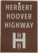
Herbert Hoover Highway
|
|
Originally designated in the 1920s as a spur from the Lincoln Highway
to West Branch (home of Herbert Hoover) and Iowa City, this 45-mile route was revived
by local promoters in 1987. It starts at the intersection of Clinton Street and Iowa Avenue, near the Old Capitol, and follows:
- Clinton Street, Market and Jefferson Streets (one-ways), and Rochester
Avenue out of Iowa City.
- County Road F44 and IA 38 from Iowa City
through West Branch to Tipton
- IA 130 and County Road Y14 from Tipton
to US 30 at Lowden
|
|
Hiawatha Pioneer Trail
|

|
This meandering route through Iowa, Minnesota, Wisconsin, and Illinois was created by the American Petroleum Institute in 1961. After several conferences with the four states' governors, including one in Amana in September 1963, it was officially dedicated on May 15, 1964. The trail in Iowa split into north and south routes in Toledo before they re-joined in Davenport. Both branches were marked on state highway maps from 1966 through 1975, but markers remained — often staying on highways' original alignments after they were relocated — for many years after that. In June 2008 the Iowa DOT decided to abandon the trail since none of the four states were actively sponsoring it anymore and began removing the remaining trail markers, although some scattered markers remain along the old route.
The approximately 750-mile north branch followed:
- US 71 from the Minnesota state line to
Spencer
- US 18 from Spencer to near Whittemore
- IA 15 and IA 3
from near Whittemore to Pocahontas
- IA 4 and IA 7 from Pocahontas to Fort Dodge
- US 20 from Fort Dodge to Blairsburg
- US 69 from Blairsburg to Garner
- US 18 from Garner to Charles City
- US 218 from Charles City to Nashua
- IA 346 and US 63
from Nashua to New Hampton
- IA 24 from New Hampton to Calmar
- US 52 from Calmar to Decorah
- IA 9 and IA 51 from Decorah to Postville
- US 52 from Postville to Bellevue (a branch followed IA 13 and IA 3 through Elkader and Strawberry Point)
- IA 62 from Bellevue to Maquoketa
- IA 64 from Maquoketa to Anamosa
- US 151 from Anamosa to Cedar Rapids
- US 30 from Cedar Rapids to Toledo
- US 63 and US 6 from Toledo to South Amana
- IA 220 and IA 149 (now US 151) through the Amana Colonies
- US 6 from the Amana Colonies to the Illinois state line (a branch followed County Road X30 into West Branch)
The approximately 400-mile south branch followed:
- US 30 from Toledo westward into Ames
- US 69 from Ames to Des Moines
- IA 163 from Des Moines to Monroe
- IA 14 from Monroe to Knoxville
- IA 5 from Knoxville to Albia
- US 34 from Albia to Mount Pleasant
- US 218, IA 16,
and IA 1 from Mount Pleasant to
Keosauqua
- County Road J40 from Keosauqua to Bonaparte
- County Road W40 and IA 2 from Bonaparte
to Fort Madison
- US 61 and County Road X62 (old US 61) from Fort Madison
to Burlington
- IA 99 (now County Road X99) from Burlington to Wapello
- US 61 and IA 92 from Wapello to
Muscatine
- IA 38 and US 61 from Muscatine to Davenport (where it had joined the mainline route at US 6).
|
|
Iowa River Greenbelt Scenic Drive
|

|
This 32-mile route runs along the Iowa River from Alden to Eldora, entirely within Hardin County. It follows:
- Starting at County Road D20: Main Street and River Drive in Alden, G Avenue (gravel), 125th Street (gravel), County Road D15, and River Road, Union Street, Cedar Street, and Rocksylvania Avenue in Iowa Falls
- County Road D15, MM Avenue, OO Avenue, 155th Street, Q Avenue, 160th Street, SS Avenue, 170th Street (all gravel except for part of MM Avenue), and County Road S56 from Iowa Falls to Steamboat Rock
- County Road S56 and IA 175 from Steamboat Rock to Eldora, ending at County Road S62
|
|
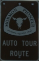
Mormon Trail Auto Tour Route
|
|
Designated in 1996 (the sesquicentennial of the Mormons' trek across
Iowa), this route roughly follows the Mormons' westward journey from Nauvoo,
Illinois, into Utah. The 314-mile route through Iowa follows:
- I-680 and I-29 from the Nebraska border through Council Bluffs
- IA 92 from Council Bluffs to Greenfield
- IA 25 from Greenfield to Creston
- US 34 from Creston to Osceola
- US 69, County Roads J20 and R69, and IA 2 from Osceola to Donnellson
- US 218 from Donnellson to US 61 near Montrose
- US 61 and IA 2 from US 218 through Fort Madison across the Mississippi River
|
|
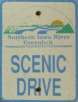
Northern Iowa River Greenbelt Scenic Drive
|
|
This is an approximately 50-mile route along the Iowa River Greenbelt between I-35 near Thornton and Alden, following:
- County Roads B65 and S14 between I-35 east of Thornton and Meservey
- County Road B63, Timber Drive (gravel), 100th Street (gravel), and Taylor Drive (gravel) before splitting into west and east branches:
- West Branch Alternate: 105th Street, Reed Avenue, 112th Street, Reed Avenue again, County Road C12, and Reed Avenue again to 140th Street outside of Belmond (all gravel except for C12)
- East Branch Alternate: Taylor Avenue (gravel), then Luick's Lane, Main Street, 6th Avenue NW, and 3rd Street NW in Belmond before ending at Reed Avenue
- 140th Street (gravel), Page Avenue (gravel), 150th Street (gravel), O'Brien Avenue (gravel), County Road C25, Quincy Avenue (gravel), 190th Street (gravel), Reed Avenue (gravel), 205th Street (gravel), US 69, IA 3, Union Avenue (gravel), 220th Street (gravel), County Road R65, County Road C48 (gravel), Washington Avenue (gravel), 260th Street (gravel), and County Road S13 from Belmond to Dows
- County Road S13, Balsam Avenue, 60th Street, Apricot Avenue, 55th Street, Youngblood Avenue, Yankee Avenue, Wright Avenue, Oakland Drive, Dogwood Avenue, 25th Street, Eagle Avenue, Hardin Street, DD Avenue, 105th Street, and EE Avenue (all gravel except for S13 and 60th Street) to Alden, where it connects to the Iowa River Greenbelt Scenic Drive in Hardin County.
- Altamont Moraine Alternate Route: Starting from County Road S13 north of Dows, County Road C47, Cardinal Avenue, 90th Street, Eagle Avenue, 80th Street, Finch Avenue, County Road S13, Oakland Drive, Fir Avenue, and EE Avenue (all gravel except for C47 and S13), ending at 105th Street in Hardin County
|

