This page is dedicated to photos submitted by viewers of the Iowa Highways Page, organized by county.
|
Appanoose County
|
|
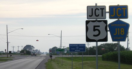
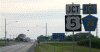
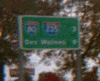
This incorrect sign is heading west on County Road J3T in Moravia. Not only is this photo in Iowa instead of Connecticut, Massachusetts, or Vermont (the sign should be IA 5), but Appanoose County isn't served by any US highways. (Photographed by Jeff Morrison)
|
|
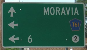
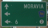
This sign in Unionville places the distance marker ahead of the IA 2 shield; it's usually the other way around. In addition, the destinations and markers are aligned to the right of the sign. (Photographed by Jeff Morrison)
|
|
Although the Missouri border is five miles away, Cincinnati is the last town on IA 5, and the distance sign leaving town lists three Missouri cities. (Photographed by Jeff Morrison)
|
|
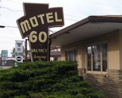
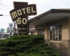
Although IA 5 hasn't been IA 60 since the beginning of 1969, this motel in Centerville is still called "Motel 60." (Photographed by Jeff Morrison)
|
|
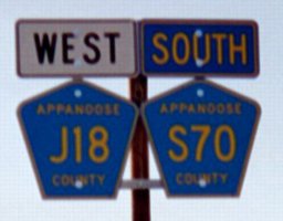
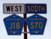
Jeff Morrison took this photo, which features two colors of directional markers, along
the former IA 142 on June 16, 2003 —
weeks after the state turned it over to Appanoose County.
"The 'West' must be left over from IA 142, but the Centerville Daily
Iowegian clearly showed that the first 142 sign leaving IA 2 was
"North". I think it switched directions when J18 left the route. This
is where the road itself changes direction (this is facing south)."
|
|
Cherokee County
|
|
This "fork" sign is on IA 3 east of Cherokee, at the point where
it splits from its old alignment (the former IA 977) and heads northwest
toward US 59. By mid-2007 the wooden sign was replaced with a metal freeway-style sign. (Photographed by Jeff Morrison)
|
|
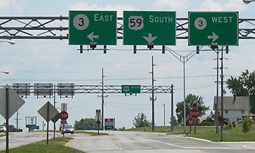
Overhead button copy signage was also present at the US 59/IA 3 junction in
Cherokee, as these two sign bridges show. Most of these signs had been replaced by mid-2006. (Photographed by Jeff Morrison)
|
|
These signs, photographed June 25, 2006, are facing south on US 59. The left two signs are new, as evidenced by the larger initial letter in the directions. (Photographed by Jeff Morrison)
|
|
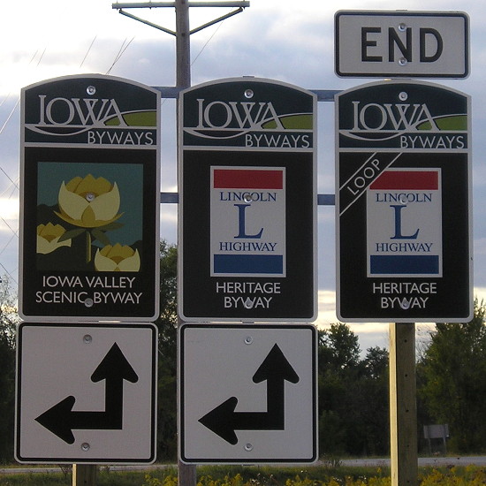
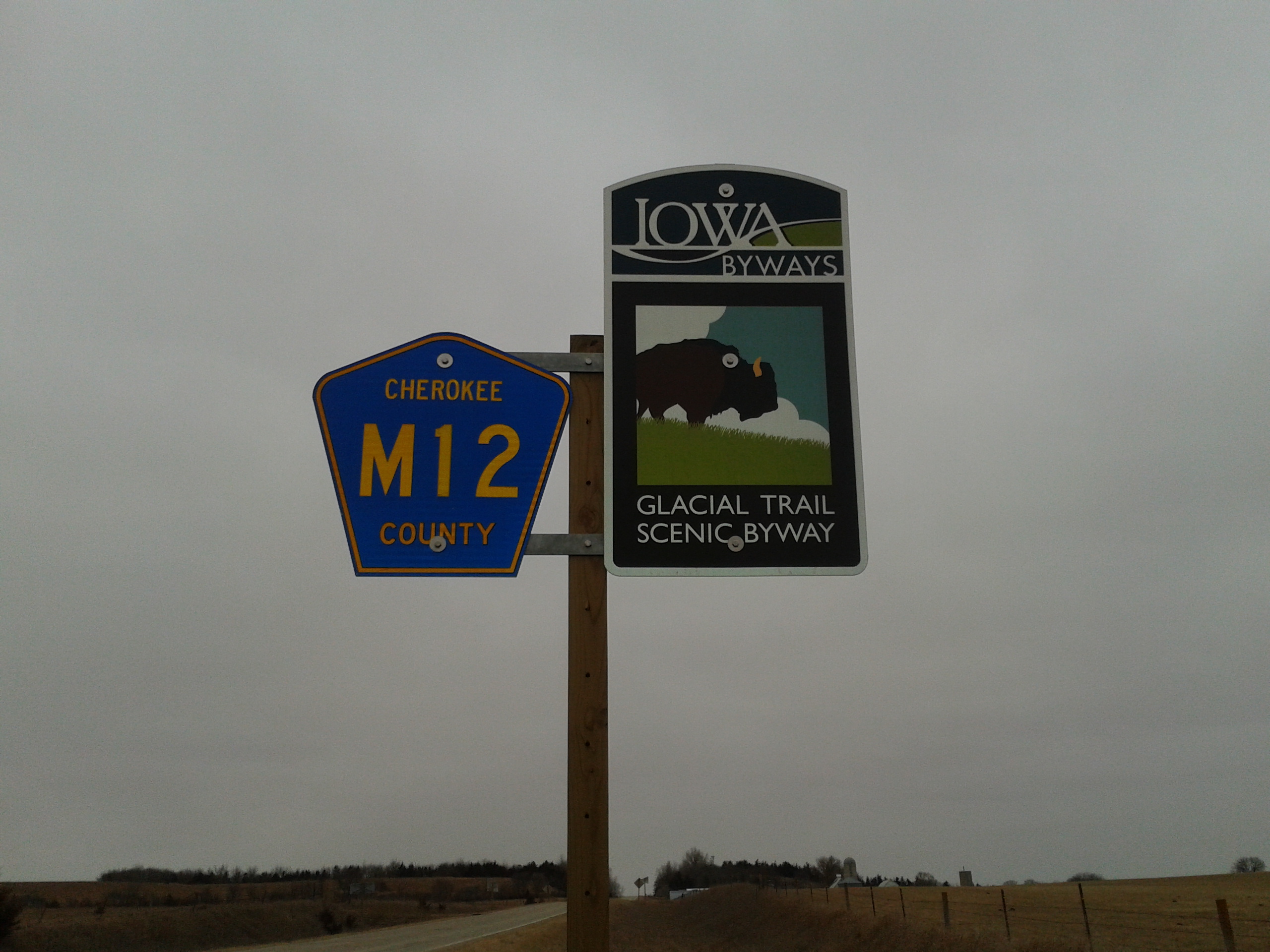
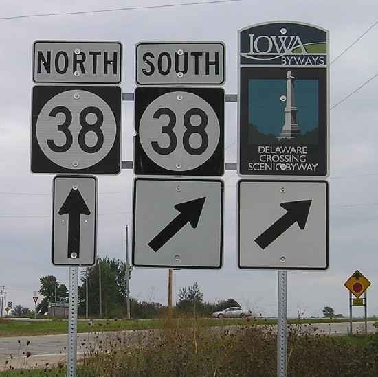
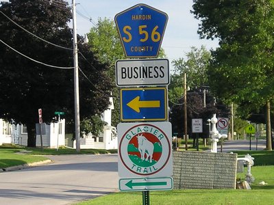
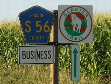
In late 2011, new signs for each of Iowa's scenic byways replaced the standard Iowa Scenic Byway signs. This is an example of the Glacial Trail. (Photographed by Michael Ehret)
|
|
Osceola County
|

|
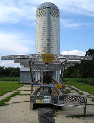
Iowa's highest point (1,670 feet above sea level) is Hawkeye Point, located in a farm northeast of Sibley off IA 60. (Photographed by Jeff Morrison)
|
|
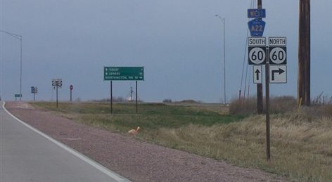
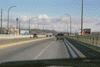
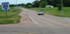
A view of westbound County Road A22 at IA 60 east of Sibley, shortly after the bypass opened. (Photographed by Michael Ehret)
|

|
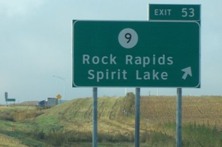
Signage of IA 60's interchange with IA 9 north of Sibley. All signs along the Sibley bypass are in Clearview, making it the first bypass to have all-Clearview signage. (Photographed by Michael Ehret)
|
|
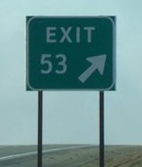
Gore signs along the Sibley bypass also feature a different design than the type normally found in Iowa: instead of an exit number tab above the "EXIT" sign, these signs have the exit number on the same sign, much like gore signs in Illinois. Similar gore signs have popped up throughout the rest of the state whenever an existing gore sign needed to be replaced since about mid-2007. (Photographed by Michael Ehret)
|
|
Polk County
|
|
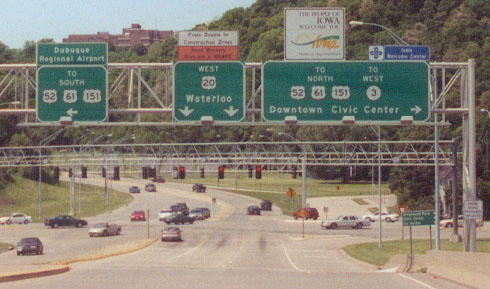
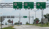
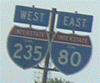
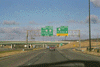
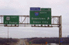
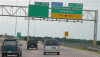
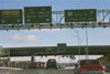
This sign giving the distance to the East Mixmaster with I-80 and I-235, photographed in October 2001, was taken down after construction to widen I-35 to six lanes in the Ankeny area started. (Photographed by Jeff Morrison)
|
|
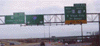
After southbound I-35 exited onto westbound I-80, but before the off-ramp to eastbound I-80, reassurance shields for I-235 and I-80 appeared. It was signed as a "wrong-way" multiplex even though there really wasn't one. After the new lanes connecting I-235 and I-35 opened in late 2007, I-235 was removed from this sign assembly. (Photographed by Jeff Morrison)
|
|
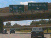
These old button copy signs were on westbound University Avenue (IA 163) in Des Moines at the I-235 overpass before reconstruction. Also note that IA 163 was not posted on the "E University" sign. And "Freeway" as a control city on I-235? The I-235 sign was taken down in December 2004 when the on-ramp to westbound I-235 was closed for reconstruction, while the other sign was taken down by February 2005 as the overpass that the signs were mounted on was removed. (Photographed by Jeff Morrison)
|

|
Button-copy print and the ghosts of the US 65/69 multiplex were also present in the sign on the right in this photo. (They were also visible in the advance BGS for this exit on westbound I-235 before reconstruction.) The sign on the left was the advance BGS for the East 6th Street/Penn(sylvania) Avenue interchange, but it was completely stripped when the interchange was reconstructed in 2003. The whole gantry was removed in late 2004 during the I-235 reconstruction. (Photographed by Jeff Morrison)
|
|
This worn-out sign on northbound Keo(sauqua) Way pointed traffic onto I-235 before reconstruction. The on-ramp followed 12th Street for a few blocks before splitting, and traffic onto both directions of I-235 merged into the left lanes of the freeway. The ramp onto eastbound I-235 permanently closed in September 2002, while the ramp onto westbound I-235 closed in July 2005 as the entire interchange was rebuilt. (Photographed by Jeff Morrison)
|
|
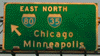
This photo from 2002 shows one of the original signs at the ramp from westbound I-80 to southbound I-35 just before I-80 merges into I-35 in West Des Moines. You can tell that a few things had changed since this sign was installed and the time this photo was taken: (1) the arrow used to point straight downward, (2) Davenport was the control city for eastbound I-80 instead of Chicago, and (3) there was a state highway marker for IA 60 (I) next to the I-35 shield. This sign dated from 1966; the original IA 60 was decommissioned in 1969 as part of the Great Renumbering. The Des Moines Register published a photo of this sign assembly in its September 17, 1966, issue, which confirmed that there was indeed an IA 60 marker on this sign. This sign was replaced in early 2003. (Photographed by Neil Bratney)
|
|
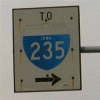
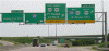
Button-copy signs were present on southbound I-35/80 at the West Mixmaster until they were replaced with Clearview signs in mid-2007. In the past there were downward-pointing arrows on these signs; even though they had been stripped off, you could still see where they used to be on these signs. Jeff Morrison, who took this photo, circled where the arrows were. (There was also an "EXIT" to the left of the arrow on the I-235 sign, but that was also stripped off long ago.)
|
|
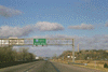
More button copy signage, this time on southbound I-35 at the ramp to eastbound I-235, was present until mid-2007. Again, given the way the "I-35 SOUTH" was positioned on the sign on the left, there probably was an IA 60 marker on that sign when it was originally installed. (Photographed by Jeff Morrison)
|
|
The US 65/IA 330 diagonal road was recently widened to four lanes between I-80 and US 30 southwest of Marshalltown. The original alignment was widened except for a spot in northeastern Polk County — because of environmental concerns, a bypass was built in northeastern Polk County. This is a shot of the original US 65, part of which was removed after the bypass opened. (Photographed by Jeff Morrison)
|
|
Pottawattamie County
|
|
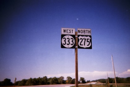
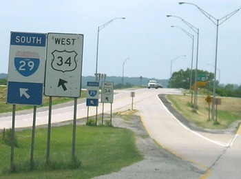
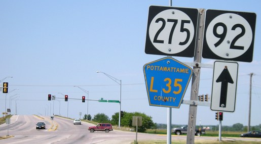
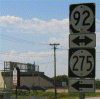
US 275, which runs through the south side of Council Bluffs, is sometimes
missigned as IA 275, as this photo from mid-2003 shows. Many of those IA 275 signs were replaced by mid-2006, including this one near the interchange with I-29. (Photographed by Jeff Morrison)
|
|
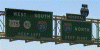
This sign gantry is visible in the above photo. By mid-2006 these signs had been taken down, as the interchange — which had a loop ramp from southbound I-29 from that prevented access to northbound US 275 — was reconfigured to allow access to northbound US 275. (Photographed by Jeff Morrison)
|
|
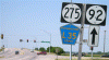
This sign was one of the few IA 275 shields remaining in Council Bluffs as of June 2006. Here is what the assembly looks like as of January 2012, when new markers for the Loess Hills Scenic Byway were placed but the IA 275 marker was not removed or replaced. (Photographed by Jeff Morrison)
|
|
Former signage for the left exit to I-29 northbound from I-80 eastbound, coming in from Nebraska. This was taken down by early 2011 due to widening of the Missouri River bridge. (Photographed by Jeff Morrison)
|
|
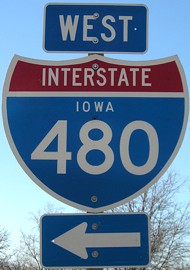
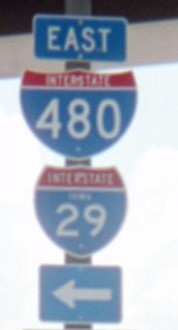
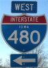
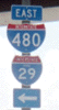
One of the few standalone I-480 shields in Iowa can be found at the half-diamond interchange at Dodge Park. (Photographed by Jeff Morrison)
|

|
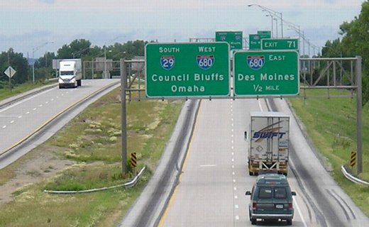
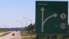
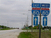
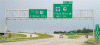
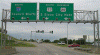
A "fork" sign is visible as westbound I-80 approaches I-680. While I-80 is marked as the main route to Council Bluffs and Omaha, I-680 is noted as the route toward North Omaha (which isn't a separate city) and Sioux City, which is accessible via I-29. More photos are on the I-680 terminus photo page. (Photographed by Jeff Morrison)
|

|
Exit signage for the I-80/680 split. The interchange with IA 191/County Road G8L, which has been the south end of IA 191 since July 1, 2003, is visible in the background. (Photographed by Jeff Morrison)
|

|
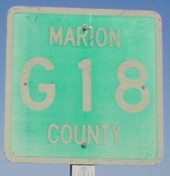
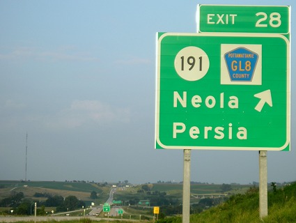
There's a goof on this sign on eastbound I-680: the county road should be County Road G8L instead of GL8. (Photographed by Jeff Morrison)
|
|
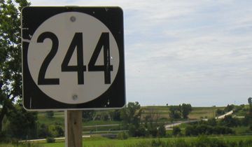
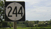
All of the former IA 244 near
Neola is visible from this photo, taken about a month before its July 1, 2003, decommissioning. (Photographed by Jeff Morrison)
|
|
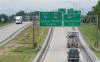
Signage for southbound I-29's interchange with I-680 near Loveland is visible from the overpass of the former IA 362, now County Road G12. (Photographed by Jeff Morrison)
|
|
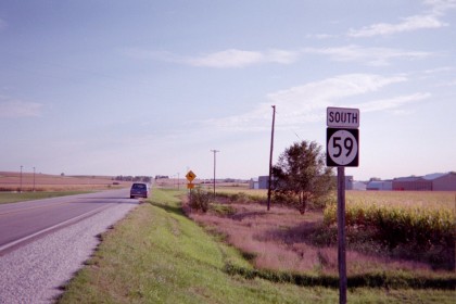
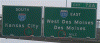
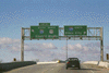
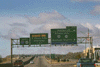
These signs, which indicate that both eastbound and westbound I-80 are straight ahead, are on southbound US 59 north of Avoca. They may be placed there to prevent traffic from turning onto the road next to the signs. Also worth noting is that the "80" on both shields is bigger than usual. (Photographed by Jeff Morrison)
|
|
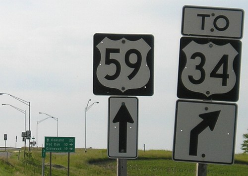
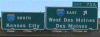
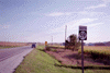
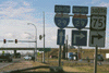
IA 59 hasn't been used since US 59 was commissioned in 1934, but this IA 59 marker was spotted south of US 6 near Oakland in 2002. (It has since been corrected.) (Photographed by David Backlin)
|
|
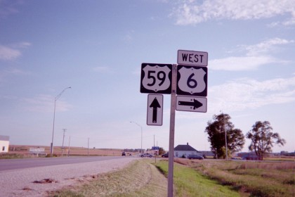
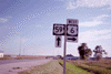
This assembly shows the correct route marker for US 59. (Photographed by David Backlin)
|
|
Although I-29 never runs through Nebraska, there's never a lack of trailblazer signage. But lo and behold, this sign in downtown Omaha — like many in the city — have the Iowa state name on them! This is on 14th Street; note the absence of a "TO" in this case. (Photographed by Jeff Morrison)
|
|
Sioux County
|
|
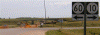
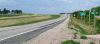
This bridge for the new four-lane IA 60, under construction in mid-2004,
is where 10 turns from south to east near Alton. An interchange was not built here. (Photographed by Jeff Morrison)
|
|
This is looking eastbound where IA 60 and 10 split. The gravel 450th
Street is ahead, but the interchange serving Alton was built here. (Photographed by Jeff Morrison)
|
|
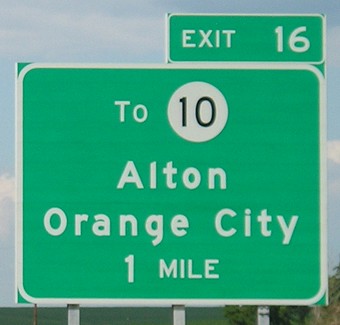
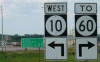
These signs were changed after the Alton bypass opened. The old IA 60 is now marked as "TO" IA 60, leading to the Alton/Orange City exit, while a new green distance sign was put up here. (Photographed by Jeff Morrison)
|
|
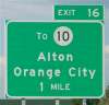
Signage for the Alton/Orange City exit along IA 60. Since the interchange is not directly with IA 10, it is marked as "TO IA 10" instead — and the initial letter in "TO" is larger, something that is usually reserved for directions on newer signs. (Photographed by Jeff Morrison)
|

|
Facing northeast, this long bridge crosses present IA 60 and the railroad
tracks just north of 470th Street. (Photographed by Jeff Morrison)
|
|
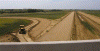
Southwest of Alton, the construction actually starts up a bit south of the
Sioux/Plymouth county line. (Photographed by Jeff Morrison)
|
|
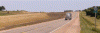
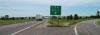
The completed expressway at the county line in 2006. Note that the Sioux County marker was replaced with a new, larger one. (Photographed by Jeff Morrison)
|
|
This is the future interchange with 470th Street, two miles south of IA 10.
IA 60 splits from the old route just south of here. This gravel road is
on a straight line with B58 west of K64. (Photographed by Jeff Morrison)
|
|
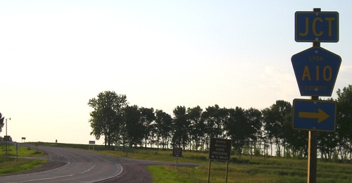
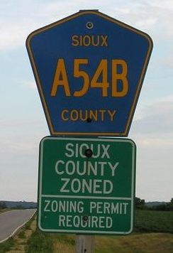
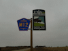
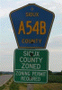
Lyon/Sioux County Road A54B, running southeastward from Beloit to US 18, is one of a handful of four-digit county roads that do not follow the regular letter-number-letter format. (Photographed by Jeff Morrison)
|
Woodbury County
|
|
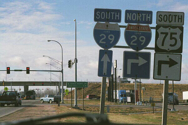
The former "wrong-way" multiplex of I-29 and US 75 is shown in this November 1999 photo by Eric Peterson, looking west on Singing Hills Boulevard. From 1984 to 2001, I-29 and US 75 shared the segment between US 20/I-129 and Singing Hills, but the multiplex was dropped when the US 75 bypass opened in November 2001 and a "BUSINESS" banner has replaced the "SOUTH" banner.
|
|
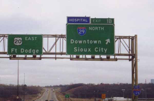
These signs were photographed on northbound I-29 approaching I-129 and US 20 in 1999. While the sign on the right was replaced to add US 75 and the control city of Le Mars, the sign on the left has not been replaced, and the text "I-129" is still around. (Photographed by Eric Peterson) |

|
The sign in the first photo shows the advance exit sign for I-129/US 20 from southbound I-29. After US 75 became part of the freeway in 2001, US 20 and US 75 markers were retrofitted into the existing sign, but by mid-2004, the entire sign was replaced, and it was taken down altogether by the spring of 2012 due to the ongoing reconstruction of I-29. (Photographed by Eric Peterson)
|
|
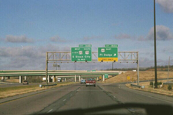
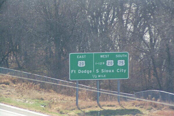
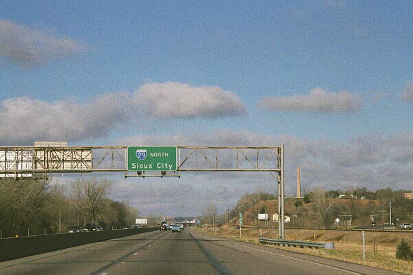
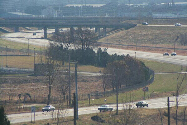
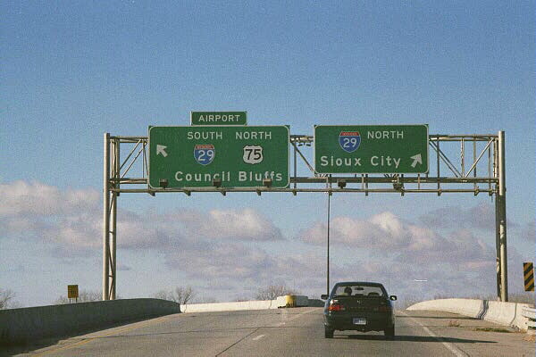
This is the sign bridge for southbound I-29 at I-129/US 20. The first photo dates from November 2001; although the US 75 bypass had just opened, US 75 was still on the Singing Hills exit, but that was stripped a short time later and never replaced. The only note of Business US 75 along I-29 is at the southbound exit sign south of here. An additional note: Exits 144A and 144B split apart after exiting from I-29; this is one of two flyover ramps in this interchange. And "EXITS" is missing from that tab for some reason. By the spring of 2012, these signs had been taken down because of the I-29 reconstruction. (2001 photo by Neil Bratney; 2005 photo by Jeff Morrison)
|
|
This view is looking northward along I-29 north of the US 20 interchange. The 100-foot high Sergeant Charles Floyd Monument, commemorating the man who died here during the Lewis & Clark Expedition in 1804, is in the background. This sign bridge was taken down by the spring of 2012 because of the I-29 reconstruction project. (Photographed by Eric Peterson)
|
|
Here is a close-up view of what was then US 75 crossing under the US 20 freeway in this November 1999 photo. US 75 is now Business US 75, but either way, there is no direct connection between the road and US 20. (Photographed by Eric Peterson)
|

|
The "END I-129" assembly is visible on the second sign bridge heading east (toward the bottom right-hand corners of these photos); this is, as far as I know, the only free-standing I-129 shield in Iowa. The first photo was taken shortly after the US 75 bypass opened in November 2001, but there was no indication that US 75 continued onto US 20. That was changed shortly afterwards, as US 20 and US 75 markers and directional banners were retrofitted into the space above "Ft Dodge" in the sign. By June 2005, as the second photo indicates, it was replaced with a completely different sign. The "END I-129" assembly was taken off the pole by April 2012. (2001 photo by Neil Bratney; 2005 photo by Jeff Morrison)
|
|
All traffic from westbound US 20 uses one ramp to exit onto I-29, but that ramp splits into two after leaving US 20; this is the other flyover ramp at the I-29/I-129/US 20 interchange. Since this photo was taken in 1999, US 75 has been stripped from the sign on the left. (Photographed by Eric Peterson)
|

|
This is a general view of US 20/75, looking west toward I-29 and I-129. (Photographed by Eric Peterson)
|
|
This is the first exit along the US 20/75 freeway east of I-29, photographed before exit numbers were added to the freeway in early 2001. Lakeport Road, which is now Exit 1, serves Southern Hills Mall and other shopping areas. (Photographed by Eric Peterson)
|
|
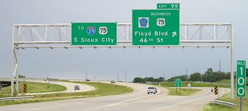
These signs are on southbound US 75, where it splits from its former alignment through Sioux City onto the freeway bypass that opened November 19, 2001. County Road D12 and Business US 75 (at its north end) are pictured on the right. One thing to note is that this is Exit 99 even though this interchange is eight miles north of US 75's entrance into Iowa; the pre-1984 mile markers are still used north of US 20. (Photographed by Jeff Morrison)
|
|
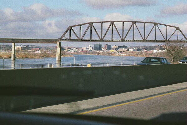
The Sioux City skyline is visible underneath a railroad bridge in this November 1999 photo along I-29. (Photographed by Eric Peterson)
|
|
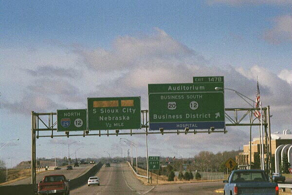
The photo on the top was what the sign bridge on I-29 northbound at Exit 147B looked like in November 1999. ("Wesley Way" was boarded up because of the Perry Creek flood control project that ran from mid-1999 to November 2001.) By June 2005, IA 12 was removed through Sioux City, Wesley Way reopened as Wesley Parkway, and the Municipal Auditorium was expanded into the Tyson Events Center. Yet there is no mention of Business US 20 on the new sign. (Photographed by Eric Peterson)
|
|
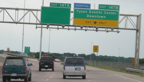
On southbound I-29, the sign for Exit 147B was also recently replaced with no mention of Business US 20. But the sign on the left, save for the exit tab, was completely blank when the first photo was taken on June 12, 2005. The top line read "Floyd Blvd" but was stripped off for some reason (the sign at the ramp still had it), while the second line read "Stockyards," which was taken off after the Sioux City Stockyards closed. In 2006 the sign on the left was completely replaced by a new sign showing Historic 4th Street as a destination. (Photographed by Jeff Morrison)
|
|
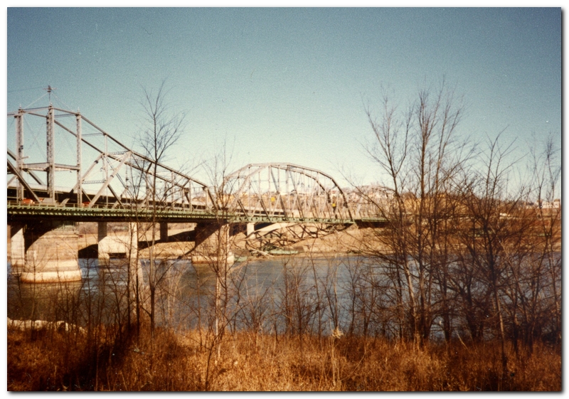
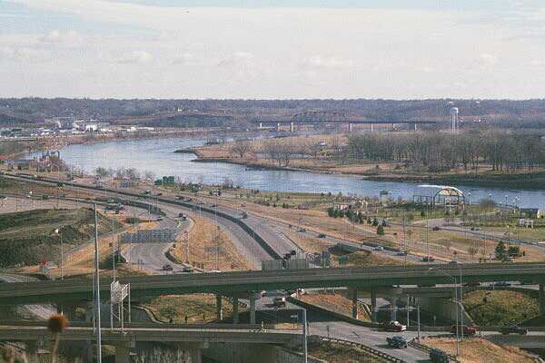
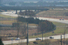
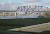
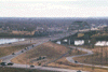
This is a 1999 view of the Siouxland Veterans Memorial Bridge and part of the "volleyball" interchange from Prospect Hill in Sioux City. The Missouri River and South Sioux City, Nebraska, are visible here. Reconstruction of this interchange, once dubbed "Iowa's Most Stupid Intersection", began in March 2012. (Photographed by Eric Peterson)
|
|
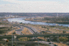
This is another view of the "volleyball" interchange and I-29 looking eastward from Prospect Hill. (Photographed by Eric Peterson)
|
|
All three decks are visible in this 2001 view looking southeast toward the "volleyball" interchange. (Photographed by Neil Bratney)
|
|
These signs, photographed in 2001, are looking westbound on the middle (interchanging) deck of the "volleyball" interchange. (Photographed by Neil Bratney)
|
|
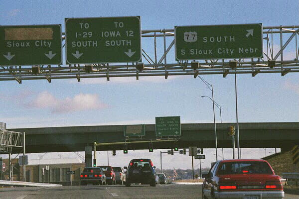
This 1999 photo is from the off-ramp from southbound I-29 where it intersects the southbound off-ramp from Wesley Parkway/US 77. Since this photo was taken, "Wesley Pkwy" was put back on the sign on the left and the "TO IOWA 12 SOUTH" was stripped from the sign in the middle before all of these signs were taken down in the spring of 2012 because of reconstruction of this interchange. (Photographed by Eric Peterson)
|
|
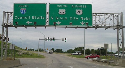
These signs were found heading south from the Wesley Parkway off-ramp toward the intersection with the I-29 north off-ramp in 2005. The sign on the right showed that Business US 20 follows US 77 into Nebraska, even though signage of Business 20 is sparse in South Sioux City. They were taken down when reconstruction of this interchange began in the spring of 2012. (Photographed by Jeff Morrison)
|
|
A November 1999 view of Business US 20, which follows the Gordon Drive viaduct east of downtown. (Photographed by Eric Peterson)
|
|
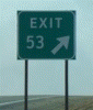
The gore sign for I-29 Exit 134 near Salix featured both the exit number and the word "EXIT" in the same sign, instead of having a tab with the exit number. It has since been replaced. (Photographed by Jeff Morrison)
|
|
This unusual I-29 sign was spotted at the west end of IA 141 near Sloan. (Photographed by Jeff Morrison)
|