How does this work?
Here is a sample exit list:
Exit
number |
Eastbound exit
(scroll downward) |
Westbound exit
(start at the bottom) |
Points of interest and notes |
|
|
EAST
|
WEST
Capital City
|
|
|
67
|

North Haverbrook
Farmer City
|
Springbrook State Park
|
|
(69)
|
REST AREA
|
|
|
(70)
|
WEST COUNTY
MIDDLE COUNTY
|
|
|
|
WEST
|
|
|
72
|
 NORTH NORTH
Shelbyville
(EXPRESSWAY)
|
|
|
|
EAST
|
SOUTH
|
|
|
|
|
74
|
University Avenue (Middletown)
|
State of Shock University
|
|
75
|
BUSINESS 
Main Street (Middletown)
Morris
|
Main Street (Middletown)
Morris
|
Business District
|
|
National Pizza Box Museum
|
|
77
|
Fake Street (Middletown)
|
|
|
|
|
|
WEST
|
NORTH
|
|
|
|
78
|
SOUTH
Springfield
(FREEWAY)
|
Richmond
Middletown Regional Airport
|
|
|
EAST
Utopia
|
|
|
Exit
number
|
Eastbound exit
(start at the top)
|
Westbound exit
(scroll upward)
|
Points of interest and notes
|
These tables have separate columns for different directions. If an exit
is signed differently heading eastbound than it is westbound, it appears in separate
columns with the appropriate text. (In the example above, Business US 63 and IA 122 are signed for eastbound traffic at Exit #75, but only IA 122 is signed for westbound traffic.) The same is also true if there is no westbound exit at that point — it is only listed in the eastbound column with green space in the westbound column, like Exit #77 above. On the other hand, if signage in both directions is the same, the sign straddles across both columns. Changes in route numbering and speed limits are also noted in the exit columns. In the above example, southbound US 63 joins eastbound I-80 at Exit #72 and leaves it at Exit #78.
These tables read from west to east or from south to north (like mile markers
and exit numbers do), so eastbound or northbound traffic must scroll downward from
the starting point while westbound or southbound traffic must scroll upward. There
are links at the top and bottom of each list for traffic heading in the opposite
directions.
The column at the far left lists exit numbers and approximate mile markers
where anything other than an exit occurs (such as rest areas, river crossings,
speed limit changes, and state/county lines). Such numbers, as well as exits on
highways without exit numbers, are noted in parentheses. Major at-grade
intersections and stoplights, where applicable, are also noted in this column. (At-grade intersections are included on exit lists if there is a traffic signal or four-way stop at that intersection, the route numbering on the highway changes, or if there is a gap of more than 20 miles between interchanges.)
The column on the far right lists points of interest and other supplementary signage,
as well as warnings and notes that may be associated with this exit.
Unless otherwise noted, all exits are from the right-hand lane.
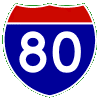
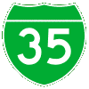
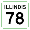
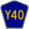
Route markers:
|
|
Interstate highway
|
|
Interstate business loop
|

|
US highway
|

|
Iowa state highway
|
|
Illinois state highway
|

|
Missouri state highway
|

|
Nebraska state highway
|
|
Iowa county road
|
Links to other exit lists can be accessed by clicking on the appropriate route markers.
A list of linked routes will appear at the top of each list.
Background colors:
|
Green
|
Guide signs, points of interest
|
|
Blue
|
Rest areas, tourist information centers
|
|
Brown
|
Recreation areas
|
|
Yellow
|
Warnings and hazards
|
|
Orange
|
Construction information
|
|
Dark green
|
Route markers
|
|
White
|
Speed limit changes
|
|
Gray
|
County and state boundaries
|
|
Aqua
|
River crossings
|
Green, brown, and blue signs in this table are usually the same as those
on the signs themselves; they sometimes stray from the general guidelines noted above.
Routes, directions, city names, and street names not posted on the mainline signs are shown in parentheses. Text that does appear on signs are in bold type.
- Directions are included in parentheses if the highway runs in only one direction from the interchange and if they are omitted from the sign. Likewise, a "TO" in parentheses is included if the interchange is not directly with the road that is signed and the "TO" is omitted from the signs.
- In Iowa, county roads that are not posted on the signs are listed if (1) they are signed in the field, and (2) they lead to any of the destinations on the signs. For instance, at I-80 Exit 271, County Road X64 runs northward from I-80 while US 6 and IA 38 run southward, but X64 does not lead to either of the posted destinations of Wilton or Muscatine. For adjacent Exit 267, County Road X54 is listed in parentheses because it leads to the posted destination of Moscow, which IA 38 does not.
- Sign errors in the field are corrected on these exit lists. For instance, US 34 Exit 263 is signed as County Road 99, the original designation for the former IA 99, but the exit list shows its current designation of County Road X99. Likewise, I-80 Exit 76 is signed as County Road N54 South as of late 2011, but N54 really continues northward from I-80 toward the destination of Adair, so the direction is omitted here.
- If a secondary destination is signed in one direction but omitted in the other direction, that destination is listed as if it is signed in both directions unless that destination is closer to another exit in the opposite direction, in which case it will be noted with a "Use Exit ___" notation. (Example: Jack Trice Stadium is signed on I-35 at exit 113 southbound but it is not signed at all northbound, where traffic can access it via Exit 111B.)
Additional notes about the exit (e.g., whether it is in one direction,
or whether the route is a freeway or expressway) are noted in yellow text in the exit
columns. Local terminology over what is called an "expressway" can vary — I
use "freeway" for multi-lane divided highways that have no at-grade
intersections, and "expressway" for divided highways that can have speed limits
of 65 miles per hour but have at-grade intersections. (The "freeway" label is not
included with Interstate highways since they are freeways by default.)
Speed limits listed here are the regularly-posted speed limits; they do not account for school zones, changes that occur as a result of road work, or any other temporary reason. This page assumes no responsibility for any speeding tickets or other traffic violations that occur as a result of using these lists.
Acknowledgments and sources:
Formatting for these tables was inspired by various online exit lists.
Signs for these pages were inspired by David Kendrick's Shields Up! page, using the Roadgeek 2005 series of fonts from Michael Adams (which is available right here).
All exit lists have been field-checked through personal observations on
road trips at one time or another. Printed sources such as state highway maps and the Interstate Exit Authority, a now out-of-print book that listed almost every freeway exit in the United States, have also been consulted.
Despite these sources, the tables probably are not 100% accurate. If
you have any additional information or corrections that need to be made
(based on what you've seen), please let
me know.
Back to Freeway Junctions of the Heartland
© 1998-2014 by Jason
Hancock / Last updated January 11, 2014